

In hindsight, I’m glad that this portion of the trip worked out the way it did. Christmas Day wasn’t spent alone, a little extra time with the parents and the weather managed to get a bit better as time went on. Also, was able to reprocess the trip in my mind and assess doing it solo. After thinking it through, I was overthinking it. There was nothing to be scared of. No crazy or dangerous roads, not nearly as remote as I’ve been in the past. So that was a breath of fresh air and a solid and much needed reset. Never hurts to check yourself every now and then.
With reevaluation out of the way, the Monday following Christmas I took my former room mates (parents) on a day trip along the mountains that their house backs up to. They really enjoyed the portion of the Mojave Road and were excited about what I had in store for them.
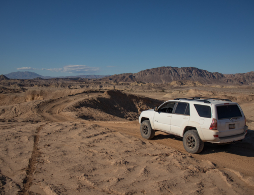
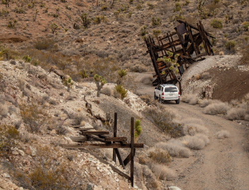
We left the house and headed north from Fort Mohave, then worked back into the Black Mountains which overlooks the Valley and Lake Mohave. Nestled up in a canyon is a unique mine, the Tyro. What makes it interesting is that overtime they worked from the surface following a vein, then had portals and shafts that shoot off from there into the mountain. I’ve never seen anything like it and it was a blast to explore.


Looking down towards Lake Mohave


The Tyro mine is 6 miles by road from the Katherine mill. The drop in altitude from mine to mill is 2,000 feet . During 1915 and 1916 a 500-foot shaft was sunk and some drifting done on the 200 – foot level . A small tonnage of ore was taken out at this time from pockets at the surface , but the operators missed an ore body that outcropped just below where the shaft was started .
In 1933 , C. F , Weeks and W. E. Whalley obtained a lease and option on the property and formed the Whitespar Mines Cos work at the mine began in September 1933.
In March 1934 , 40 tons of ore was being mined daily from an open cut on the vein . A part of the dump from the old shaft had to be moved to get at the ore . The mill took the ore in lots of 80 tons. The ore was drilled with a jackhammer and hoisted in a 10 – cubic foot bucket by a small gasoline hoist . The bucket was dumped into a car , which was pushed by hand to a 60 – ton bin . The mining was done on contract at $2.50 per ton .
The crew consisted of 10 men 2 miners, 4 muckers, 3 hoistmen , and the contractor . Wages were $4.50 for miners and $4.25 for muckers. The output was 6.6 tons per man shift for the men in the stope and 4 tons per man – shift for the entire force.
The ore shipped in 1935 averaged 0.42 ounce per ton in gold. Surface sampling along the outcrop for about 900 feet indicated a value of $ 5 to $6 per ton.
In May 1935 electric power had been brought to the mine . The equipment consisted of a 500 – cubic foot electrically -driven compressor , two 100 – cubic foot portable gasoline compressors ( standby ) , mine blacksmith shop, and a 100-ton ore bin.
The compressor was rented at $2.50 per day and the hoist at $20 per month. The compressor used 15 gallons and the hoist 5 gallons of gasoline per day.
In May 1935 , 100 tons per day were being taken out of the mine through the adit . The ore was mined in 6-foot benches . The blasted ore was drawn through three chutes , without shoveling , into cars that were pulled by a mile to the ore bin in trains of four cars each .
The stope crew consisted of one jackhammer man and one helper on each of two shifts . Two small shrinkage stopes had been run at the ends of the open stope where the ore would not run without shoveling .
No timber had been used for supporting the walls in the open stope up to January 1936. All loose rock had been cleared away at the surface and a wire guard placed around the excavation .
The mining cost, at 100 tons per day in 1935 , was $1.20 per ton. On a 50 ton basis the cost was $1.75 . One – half mile of road up a sandy gulch was built for $ 150. A power shovel was used for grading . Little blasting was required . A single track road in disintegrated granite in which no blasting was necessary was built by hand. One man at $4 averaged 16 feet of road construction per day making the cost per linear foot $0.25 . – Source Credit Gold Mining and Milling in the Black Mountains


Such a amazing mine to explore. It’s all still in really good shape other than the wooden structures that are exposed to the elements. A few of them won’t be around too much longer as where they’re anchored and secured to the rock and each other is showing signs of the time and weather.
From the Tyro mine we crossed highway 68 and headed south, skirting along the western slopes of the Black Mountains. There’s a ton of old history scattered throughout this range varying from early day expeditions and scouting, battles with Indians to the earliest mining activity in Mohave County, dating back to 1863.
Two of the more notable present day attractions are old Route 66 and the historic old mining town of Oatman.
The adventure for today wouldn’t have time to check out everything unfortunately, but it’s something I’ll chip away at each time I’m out there for a visit. For a lot of the trip we tinkered around the Arizona Peace Trail for simplicity and timing.


Two very solid individuals. I’m fortunate.


The Bra and Panty tree. One of those oddities, albeit a little trashy IMO.
Saw a few groups of these guys. Always a treat. Fascinating how these big animals thrive out here.
More wild burros call Arizona home than anywhere else in the West. Close to 7,000 burros are estimated to roam the western part of the state, where these hardy animals are highly adapted to the harsh desert environment.
One of the largest and most genetically healthy burro populations in the country lives in the Black Mountain Herd Management Area (HMA), a 1.1 million-acre public lands area. The burros are thought to be North African Ancestry and are descendants of burros that were brought by miners and prospectors from the early 1860s.
The burros share the mountains with the largest herd of desert bighorn sheep on public lands in the nation. – Source Credit americanwildhorsecampaign.org

Worked our way further and further to the south, closing in on Oatman.


Ended up at Fort Red’s. A really neat and super clean desert bar. We stopped and enjoyed a cold beer, lunch and talked with the locals for a bit.


I really wanted to stop and explore Oatman and a portion of Route 66 in detail. I’ve learned so much about it and it’s vibrant history I was itching to go back once again, returning with new found knowledge and history. Thinking it was a Monday and everyone would have went home it’d be dead, but it was by far the busiest I’ve seen it. So busy in fact, we drove right through. Bummed! That was going to be a key segment to this part of the trip.
Oh well, I’ll get something planned that’ll incorporate Oatman into some of the other rad historic finds I’ve made.


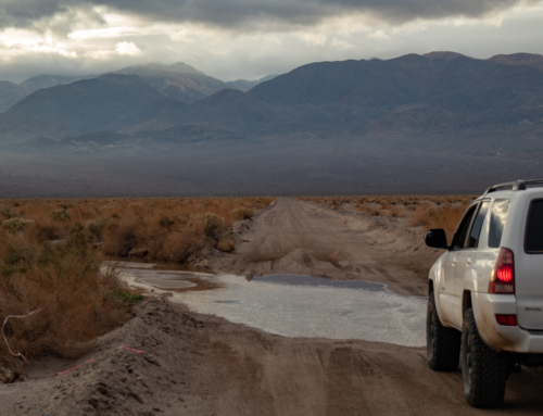
From Oatman we took dirt trails back to my parents house.


My spirit animal
All in all, it was a great trip and any time I get to spend with them is precious and always a joy. A couple more days at their house and it was time to dive back into the trip.
To be continued!
Leave a Reply