

Burns Canyon – AKA the long way to Pioneer Town.
With no plans for Friday after work into Saturday, another quick trip was in order. For a while now I’ve been wanting to grab a yellow post site up in Big Bear and camp up in the mountains then explore a couple things I’ve wanted to see along Burns Canyon on the way back down.
The new and basic truck setup makes it easy to just go, and that’s what we did. Threw in the cooler, bedding and whatever else then headed out. Lucked out on traffic and ended up at The Village for dinner in under an hour and a half.


As we were finishing up dinner, the sun began to set and was a indication it was time to see if any sites were available. Drove to the north side of the lake and headed into the mountains behind Fawnskin to find a spot, and unfortunately they were all taken. I had a feeling with some sort of Jeep event going on and all the off-road vehicle activity on the roads a lot of people had the same idea in mind.
Striking out on the north side, decided against driving to the south where a few more yellow post’s are located. It’s quite a ways in to their location and wasn’t worth the time to come up empty handed again since it was already 11:00pm.
Down off Hwy 38 by Heartbear Campground there’s a bunch of sites located closely together which makes it easy to do a quick drive through to see if a spot was free. Worst case, we’d be able to just hop back on the highway and head home. So we drove there anddddddddddddddd no luck. Every post was taken.
Bummed about not finding a place and torn on what to do, Candace and I sat aimed at road that would take us home but didn’t want to head that way. Candace asked “what about Lucerne?” and the wheels started turning. It was closer than home, wouldn’t be complete defeat and position us to still do Burns Canyon.
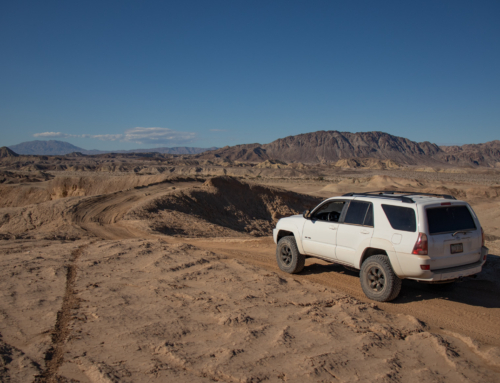
An hour later and we were in the desert, let alone one of my favorite places to camp – Couger Buttes. Time we got there it was nearly 2:00am and sleep was inevitable, although the full moon lit the area like it was day time.
But first, lemme take a picture…


Few hours after falling asleep, the air mattress we had bought gave me a solid reminder on why I don’t use them. Got everything out, pumped it back up and tried to go back to sleep but that didn’t last long before we were in the same position. I hate air mattresses. The worst.
Nice morning nonetheless. We didn’t plan on cooking breakfast on this trip so we packed up real quick and hit the road back up the mountain.


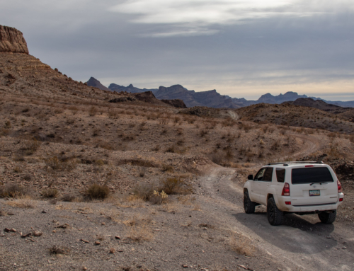
There’s a bunch of information out there on Burns Canyon so I’m not going to dive too deep into it. Basically a 18 mile trail that goes from Baldwin Lake to Pioneer Town. There’s not too much to see of 2n02 (Burns Canyon) besides some old mining sites and a few great views. Can get narrow and rocky in spots which could be a problem for oncoming traffic but other then that it’s easy going.
Passed a group of Jeeps that were airing down at the beginning so I decided to head up a bit to the next clearing to do the same.


Crickey! Only one we saw but you could hear them when you got next to them on the trail.


Once you hit Round Valley the area opens up a bit before you hit the final decent onto the desert floor. Couple mines in this area but other than the Rose Mine, there’s not very much information on the remaining ones along Burns.
If your beginning to think that the Big Bear Gold Rush was mostly hype, your right. However, just east of Big Bear Valley is a place called Lone Valley, and it is was here that we find the most profitable mining operation in the San Bernardino Mountains. It was originally filed as the “Homestake Mine” in 1887. Later in 1889, James Smart, A.G. Watts, and M.F. Sweat took it over and renamed it the Rose Mine. This group operated it for two years then sold their interest to the Morongo Mining & Milling Company. The new company installed a 40 stamp mill and a 50 ton cyanide plant.
Most stamp mills are usually built on the side of a mountain next to a horizontal mine shaft tunnel. Miners would then take the mined ore and drop it into the side of the stamp mill. Gravity would then pull the ore down chutes into the waiting stamps to be crushed.
The Rose Mine mill was different. It was built in the middle of a flat valley on top of a mine shaft that went straight down. Because of this, the Rose Mine stamp mill had a tower that can be seen above the roof line. The tower housed a pulley system that was needed to haul the ore up out of the ground.
The Rose Mine stamp mill. Since the mine shaft ran vertically down into the ground, a pulley system was needed to haul the ore up out of the ground. This system was housed in the small tower located on the roof. – Rick Keppler Collection.
The Rose Mine vertical shafts went as deep as 450 feet. At various levels, horizontal shafts reached out as far as 2,000 feet. But it was worth the extra expense. While the Gold Mountain Mine was getting all the publicity, the Rose Mine was quietly producing high grade ore that consistently assayed out at $200 to $500 per ton. Up until 1906, it was estimated that between $600,000 to $1,250,000 in gold was pulled out of it’s maze of underground tunnels.
The Rose Mine has been shut down for almost 100 years. Recently however, this mine was purchased by a group of investors. It is now under consideration to either preserve it as a historical site, or to reopen it as a working mine.
Source – Big Bear History Site


Coming into the Rose Mine area. The dirt changes color here and you can see significant work done on both sides of the trail while it was under operation. Not too much to see unless you walk and explore the area.


Some small rock foundation work at the Rose Mine
Last portion of trail before turning onto Viscara Spring Rd where the few things I wanted to see are located.


Once on Viscera Spring Rd you start to see the beginnings of civilization – a few properties with housing are sprinkled throughout the valley. The trail continues north and connects to New Dixie Mine Rd and Rattlesnake Canyon. Neither of those were on the list of things to see this time around, but a few cabins and a spring had been on marked on my map for quite some time and finally had the opportunity to see in person.
The first that comes into view is the BLM Cabin, perched up on a hillside overlooking the wash and valley below. No one was there so put the truck into 4-low and climbed up to take a closer look.
Things like this reminds you that there’s a lot of people out there that suck. No self respect or environmental awareness, trashing places that once had life and memories for the satisfaction of destruction. Bummer, since this would make a really nice place to stay.
This is local enough that I might even look into what it would take to coordinate with the BLM and local groups to restore.


Spent a good amount of time at the BLM cabin. It had a good feel to it- good bones. Real shame it’s in the condition it currently is. Looking down we could see the next stop. Another cabin although this one had no name and no information that I could find. If you look closely you can see it in the distance.


Once again, this would be a great BLM Adopt-A-Cabin. It already relatively clean and sturdy compared to a lot of others I’ve seen.


BLM Cabin off in the distance


From here there was another cabin I wanted to see just to the west, but looking at it from our current location it almost appeared as if it was occupied or maybe a private setup. Decided against investigating it further and continued on to Vaughn Springs. Surprisingly enough and like the springs in Cal-City, there was a small natural pond that had gold fish in it.


Unfortunately it was about that time to start making our way towards home. So much to see and never enough time to do so. Ended up backtracking towards Burns Canyon and decided to see one more area – another old mining camp. Located down in a small valley/wash, it wasn’t apparent until we got close that it was already occupied. Will have to come back at some point and check it out.


Looking down on the old mining camp
Took a slight detour to see the Farrington Observatory on the way back to Burns Canyon.
If you have driven Burns Canyon Rd. from Rim Rock to Big Bear you probably noticed the observatory building in Antelope Valley on the right approximately 9 miles in.Very little is actually know about the observatory. It was built by Dr. William B. Farrington and his sons in the early 1970’s. The telescope was also built by Dr. Farrington using lenses he had ground during off-duty hours while serving as a radio officer on a destroyer in the Atlantic during WWII. The astronomical visibility in the 1970’s must have been incredible since there was very little, if any, “commercial light” infiltration from Pioneertown, Yucca Valley or Twentynine Palms.
The property was sold in the late 1970’s or early 1980’s and was rented to a “desert rat” for about 6 years whose friends pretty well stripped it when he was moved out. It is not known who owns it now. In June of 2006 the site was visited by the geocachers DZRTGTLS who posted one of the photos below. The telescope housing & lenses were still there at that time and the domed roof appeared to be in pretty good shape. The Farrington Observatory was obviously a labor of love and could not have been an easy construction at the time and in that location. Almost nothing else is known about Dr. Farrington, his sons or why he chose Burns Canyon for his project.
Source – Morongo Basin Historical Society


That was about the end of the adventure part of the trip. Finished up the remainder of Burns Canyon, aired up, stopped at Pappy + Harriet’s for a unbeatable lunch then headed home.


Until next time!

Did you check out the Red Cabin near the spring?
Is that the one up the hill a ways, above the spring? I had it on my maps but it looked too clean or possibly occupied so decided to steer clear this time around.
Is it a open cabin or private residence?
Yeah, that’s it. Its an open cabin. Someone does a nice job keeping it cleaned.