
Saturday morning was a early start since we’d be making the haul back to Bishop for supplies in preparation for Coyote Flats. We made quick work of packing up camp and hitting the 395 south. Couldn’t pass up Mahogany Meats along the way, although collectively we spend well over a couple hundred dollars on beef jerky. Worth it? Definitely.


Unfortunately, Ryan informed us that a family matter would put an end to continuing any further and would have to head home from this point. We were all pretty bummed, but at least it happened towards the end of the trip and many more adventures are to come. We said our good-byes and went our separate ways.
Dave and I took off, zig-zagging through the Bishop Reservation until we finally connected with Coyote Valley Rd and began the short lived slight incline to the foothills. From my research I knew that the ascent towards Coyote Flat was rather steep, but it wasn’t until being there in person was it put into perspective on how quickly you get to the 9,500Ft level. Without a doubt – the vehicle and most importantly the cooling system need to be in top shape to make the climb. In testament to that, this climb made the mechanical fan on the Tacoma go to full lock a few times along the way – the first time I’ve ever heard it do so while driving.
It’s not that it’s extremely steep per-say, it’s that it never ends…


Eventually the radical elevation gain begins to taper off as get into the upper valleys. Coyote Creek still had a fair amount of water running.


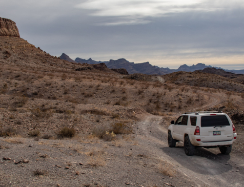
Coyote Valley Rd come’s up to it’s first split off at the 7S10 that heads south/south-east towards Baker Creek and Funnel Lake. It also continues straight via route 8S18. Since we were down to 2 vehicle and made some awesome time up the mountain we decided to go explore the area before finding a camp. That would also free up tomorrows scheduled and allow for a early departure back home.


We branched off the main route and turned south to check out Coyote “Lake”. Ended up being dry so we continued to head north when the trail ended at a series of switch backs going up the mountain side. Not looking well traveled, off-camber, narrow and on loose shale rock we decided it would be in our best interest to go for it. Up we went.
Each one of those elements I’m not a big fan of. Add them together and it’s a true butt-pucker experience. Add to the fact that we knew it ended and would have to turn around or back down. Fun.


As expected the trail became impassable and we were forced to head back down. Before doing so we hiked the rest of the way for a better view of the area.
Looking north – Coyote Lake down below and the 8S18 in the distance. Second picture is looking south-east toward Rocky Bottom and Funnel Lake.


This next portion I’m going to call “The Adventure of Dave’s 4Runner”. Rain, lots of driving and letting Dave take the lead didn’t allow for much diversity with the photography.
We backtracked down past Coyote Lake and rejoined the main trail. At the spit off we took 31E303 to the top of the ridge and above the remaining snow line.


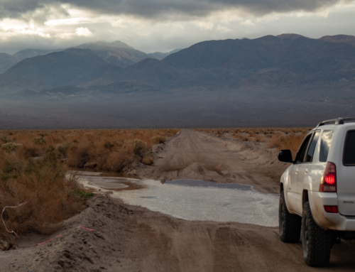
The distant clouds had made their way on top of us and brought varying severity of rain along along with them. Couldn’t have asked for better timing – the small shelf road we were just on would have been that much more intense if the rock was slippery from the wet.


Creeping up to the 11,000ft mark a small group of deer where roadside. They didn’t seem frightened and stayed put as we slowly drove by. From this point forward we saw numerous groups running through the trees – but not a single coyote. Maybe they should rename the area…


We continued south-west toward a overlook of South Lake when it started pouring rain and the temperature dropped to about 52*. I didn’t want to take the time to get the camera in it’s protective rain sleeve and now regret it. The overlook at the end of the trail was epic! We soaked in the view before becoming drenched and made our way to the Lindner Prospect. All that remains is the collapsing ore bin, remnants of track and audits that have either collapsed or been blown shut.


Next up was backtracking a bit and exploring the 8S109 and the Schober Mine.


Looking back to the ridge and where Coyote Lake is located down in the valley.

The 168 to Lake Sebrina is visible in the distance.

Winding down through the trees an old cabin at would have been the Mill site for the mining operations.


On to the Schober Mine – or lack of. Once again it appeared that the audit had been blown shut and nothing but a few remnants remained.


Continued on Part 4
this looks like a very cool place to get away from the crowded city life 🙂 would love to join your adventures !