
This report may take a little longer to load then usual due to including more images and combining into one page rather then split it up. Please be patient while images load.
I’ve always had a deep fascination for the Mojave desert. I suppose it’d be hard not to after spending countless car rides along the 15 and 40 freeways as a kid, staring out the window when boredom set in. Imagination going wild – thoughts of cactus, scorpions and snakes. Mirages tricking the eyes, imagining getting caught in a patch of deadly quick sand and maybe somewhere distant a coyote is chasing after a roadrunner. All the stereotypical things that come to mind mile after mile of “nothing”…
Fast forward quite a few years to when my friends and I got our drivers license’s and trucks. We’d spend multiple weekends toying around local fields and venturing out to the high desert to spots that were familiar growing up, but going deeper into the Mojave didn’t happen for quite some time. Although we didn’t make it that far, it laid the foundation for what was to come. We learned how to be self reliant when camping, how to drive on varying terrain and collected bits of useful tips and tricks as well.
I believe it was fall of 2003 when my friend Lennon invited me on a trip to do something called the “Mojave Road”. Unsure of what to expect, a group of us took off across the desert with our friend Scott leading the way. Now, Scott had done this particular trip many times before so he knew the in’s and out’s, as well as all the history to go along with it. All the various stops, sights and locations he’d fill us in on what he learned throughout the years. What was another trip across the Mojave to him, was a complete hook line and sinker to me. I grew fascinated with the landscapes, history and sense of being so isolated.
Thankfully in the following years Scott allowed us youngsters to follow him around on his adventures. Guiding us everywhere from Death Valley to Anza-Borrego, and just about everywhere in-between. We covered a lot of ground and saw lot’s of rad stuff in that time period, but my favorite trips were always those into the Mojave.
In a lot of ways I owe much of my desert knowledge and experience to Scott. An excellent role model and teacher that will leave a lasting impression on me. Thank you.


The reasoning behind the short backstory is I’ve made it a point to get back and rediscover some of the areas that made me so fascinated with the idea of exploring to begin with. Back then, it all seemed so remote and nearly untouchable. I was lost in the scale of things and exact locations. Over the course of the last 8 months I’ve been working on mapping out the entire Mojave Preserve – marking all the spots I clearly remembered and stumbling upon those that I forgot. Of course with modern day satellite imagery and Google, numerous new points of interest came about as well.
A weekend opened up and the weather seemed good enough so Candace and I set off on a solo adventure.
Friday night we made way to the base of the Kelso Dunes. There are a couple opportunities for dispersed camping and were very pleased to find that we had our pick of where to stay as only one other camper was there. Got as close as we could to the wilderness boundary and setup or home for the night.


Dune silhouette

As always, waking up in the morning is such a treat when arriving somewhere at night. You can Google Earth or look at other people pictures all you want – nothing compares to seeing a new view with your own eyes.
“One of the oldest and most extensive dune fields in the West, the Kelso dune complex rises more then 600 feet above the desert floor and covers more then 45 square miles – created over the course of 25,000 years.”
“The dunes at Kelso have the rare ability to “boom”. The sound occurs when sheets of sand cascade down a steep dune and rub against the stationary sand below. Only about 30 dunes around the world are known to create this sound.”


First trip with the ARB drawer and FrontRunner tote setup. Absolutely magical.
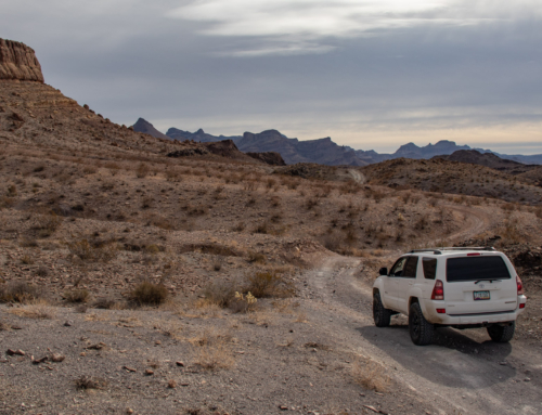
After loading up the Tacoma, we headed north on Kelbaker road. Not a far drive from the dunes, we arrived at the historic Kelso Depot.


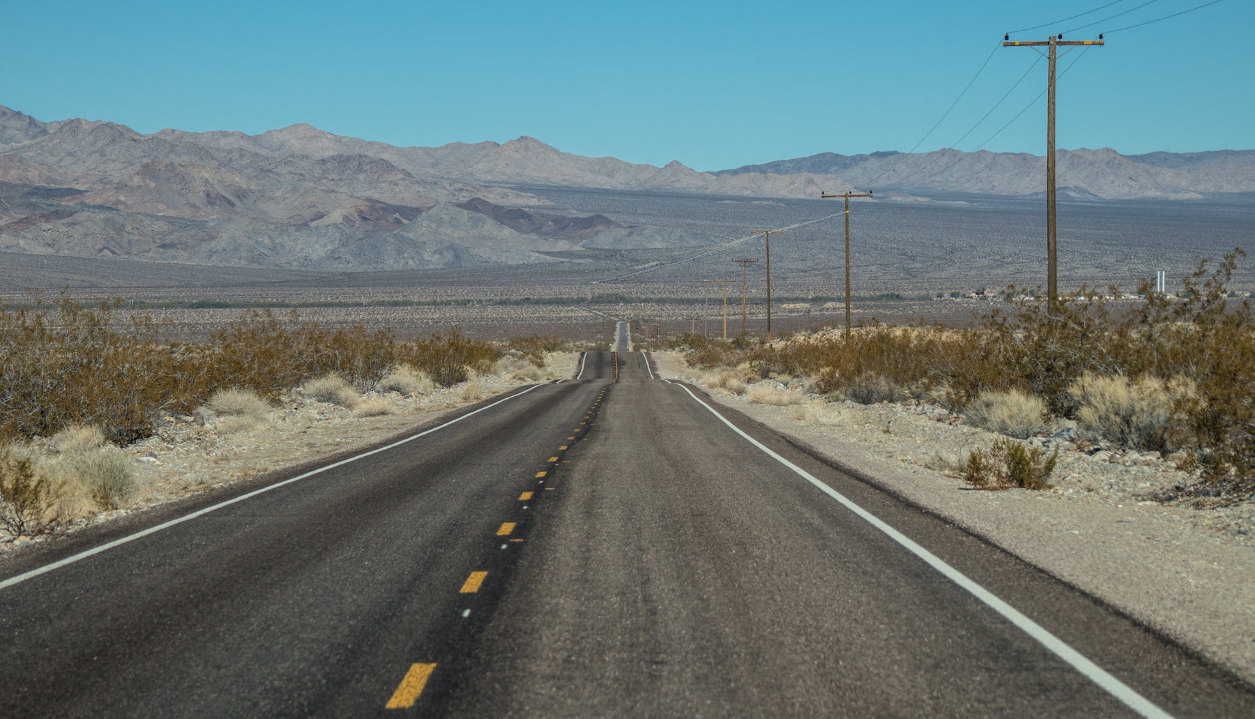
The view looking west from Kelbaker Road
Most likely because of it’s remote location and lack of interest compared to other state/national parks, this visitor center is nearly flawless and looks almost new since it was refurbished back in 2005. Hardly anyone there allowed us to take our time and read all the excerpts scattered inside and out of the property. Despite not seeming very popular, this was by far one of the nicest, informative and engaging visitor centers that we’ve been to yet.
If you’re ever in the area, make the time to see this place. It’s well worth it in our opinion!
“Built in 1924, the Kelso Depot housed a train station, ticket and telegraph office, restaurant, reading room, and dormitory rooms for railroad employees. The railroad town of Kelso arose because of the steepness of the grade beyond and the abundance of groundwater below. The Cima Grade was too long and steep for locomotives to pull a train up without assistance.”
“As railroad technology improved and fewer personnel were needed, the Depot became obsolete. It was closed in 1985 with Union Pacific planning to demolish the building. Concerned citizens intervened and the building was saved. It was renovated and reponed as a National Park Service Visitor Center in October, 2005.”


Not everything within the Visitor Center is about the Kelso Depot. In fact, a good portion is all about the history and information about the entire Mojave Preserve.


We were totally pumped about the experience at the Kelso Depot. We got to see and read all there was to offer and felt content when we left. Now we’d set off on Kelso Cima Road to meet up with the Mojave Road for a few miles at Cedar Canyon.
Tucked back behind some small hills rests Death Valley Mine. Such a odd name considering it’s nearly 60 miles as a crow flies to Death Valley National Park.
There are quite a few structures to check out – the main “house”, a smaller building to the south and the mining operation and tailing piles to south east. We only made it to the first building as the wind was howling over the snow tipped New York Mountains creating frigid conditions.
*** Before I proceed, it should go without saying that any historical artifacts, buildings, mines, signs, etc. should not be altered from it’s appearance in which you found it. Unfortunately many people don’t think outside of their actions and often times think that everyone that comes after them will enjoy seeing their bullet holes, spray paint, engraved name, broken glass and fire scorched marks.
One of the reasons I do not share specific locations to many of the places we visit is all to often they’re vandalized and destroyed. I rather keep the whereabouts to myself than risk one idiot destroying it for those that appreciate history and want future generations to see it as we did.
I’m sure most who read our trip reports have the same common sense and respect that one would expect, but for those who are maybe new or unaware to historical findings in the desert – please be considerate. Contrary to popular belief, the desert and it’s belongings isn’t a barren wasteland. ***


Courtesy of MojaveDesert.net
The Death Valley Mine was discovered in 1906 by J. L. Bright of Kelso. In July, 1906, the Death Valley Gold Milling and Mining Company of Denver took over the mine, and by September, 1906, the camp of Dawson had sprung into existence, named after the directors of the company, the Dawson brothers. The first shipment of ore left during that month, consisting of several wagons full of ore hauled to Cima by a team of 12 horses. From Cima the ore was hauled via the Salt Lake Railroad and California Eastern to the Needles smelter. At the same time, the Arcalvada Mine, adjoining the Death Valley to the northwest, was active. Both companies mined rich lead-silver-gold ore running up to 634 ounces of silver and .48 ounces of gold per ton. 194
In January, 1907, the Death Valley Company made its first ore shipment to the American Smelting and Refining Company in Salt Lake. During September 1907, the Death Valley and Arcalvada companies merged to form the Death Valley Arcalvada Consolidated Mining Company, and by November there were 75 men employed. The mines were quite busy until June, 1908, when the company became involved in litigation which was not cleared up until 1915, although some mining continued throughout this period. In 1915 a new owner took over the property, and these operations continued until 1921. Water was pumped from the shafts until June 11, 1927, when the plant and mill were destroyed by fire. The mine had produced about $131,000, $93,000 before 1915. In 1930, there was a camp that could accommodate 100 men, a thirty-ton concentration plant and a 6-room residence. Today the residence still stands, as do 3 other buildings. The property is presently occupied. An electric line connects the camp with Cima. 195


Got back in the Tacoma and proceeded to blast the heater at our numb faces. I had just about got over a head cold prior to this trip and it was about this point that some of the symptoms were coming back. Ugh. Anyways, we continued on to our next destination – the abandoned modern mine called Goldome.
Not much info can be found online other than what’s available on Death Valley Jim’s website. From his findings, it’s almost as if the whole operation was a scam or just delivered false promises. Guess we’ll never know for sure.


Tunnel Snakes Rule

There was quite a bit of exploring to be done at the Goldome, and even more if you were into all the small details scattered throughout – we had our fill though. Before moving to the next location, we used the facility as our lunch spot so we could look over the Ivanpah Valley. Great view except for the controversial Ivanpah Solor plant staining a large portion of desert floor.


Finished up our sandwich’s and chips and cruised back down into the valley via Ivanpah Road. Off in the distance you could make out Stateline, or as we like to call it, Primm. The wind had been relentless and the higher elevations we have been at, and planning on camping at, was cold and uninviting. Seeing the promise of shelter from the elements and a warm bed sparked an idea – “We’re going to Primm!!!”
But first, to go see what we came all this way for…


Primm, NV in the distance
Made our way to the Evening Star mine headframe. Amazingly, it’s still in decent condition compared to the last time I was here back in 2005. The NPS did block off all the mine shafts since then, as I remember walking back into the lower adit.
Nonetheless, very cool to be back here revisiting.


More Joshua Trees than Joshua Tree National Park…


Looking down into the valley and beyond
Once again, it’s worth mentioning that I will not disclose the location of these areas. If you do the research and find out where they are, I’d suggest you do the same. Please do not vandalize, paint, steal/remove, or shoot these historic structures! It’s so important to protect and preserve for future generations. Once they’re destroyed and gone – that’s it. This goes for everything you come across in the desert. Be smart, use your head and most of all, be respectful of others that come after you.
A short drive from the Evening Star mine are a group of “camps” tucked into the rocky mountain side. Last time to the area, about twelve years ago, all the structures and nearby land was littered from deterioration – both from desertion and the elements.


The first we came to was Riley’s Camp, built by John Riley Bembery in the 1920’s. His cabin is surrounded by numerous claims that were made throughout the years and many mining artifacts scattered about. The house itself has been under renovation by friends & family of Riley in conjunction with the NPS, and it shows in comparison to my last time here.

Picture of Riley’s Cabin from 2005


A museum of sorts – collections of items found within the area

View out the kitchen window


Geer Camp in the distance

As well as a few others
Before moving onto the remaining camps in the area, I wanted to check out a overlook above the Ivanpah Valley and the massive Morning Star mine.


Lucy’s weird infatuation with snow…
We relaxed a bit at the top of the ridge, taking in the view and incredible scenery. In warmer weather, this would be a phenomenal place to setup camp for the night. Moving on, we stopped by the Geer Camp which is located within earshot of Riley’s. While small, it was quite quaint in the fact that it was clean, basic and felt somewhat personal due to photo albums that help tell the story of it’s and surroundings past.


I wasn’t able to come up with the names of the following camps that we visited. Not sure if they were grouped together name-wise with the others, or if I didn’t dig deep enough to find information. History can be somewhat lacking or missing for a lot of area’s scattered throughout the desert – most likely lacking from any desire or reason to document the activity of the time.


Looking back at Riley’s Camp

And looking down towards the Geer Camp
So much to explore in this area you could spend an entire weekend combing over all the small things and historic details. But unfortunately time wasn’t on our side, nor was the weather. We continued on to the last two sites in the vicinity.


Last of the 4 camps in the area off in the distance and our last stop before our drive to Primm.


Leaving, we took a trail that dropped us off into Piute Valley where we would pick up Zinc Mine rd to take us the remaining distance to the I-15 freeway.


Before long you can see mining activity below Kokoweef Peak, and that’s a interesting story in itself. I’d highly suggest heading over to http://kokoweef.com and http://mojaveproject.org/dispatches-item/kokoweef-still-searching-for-the-lost-river-of-gold/ to read the history and legend of the mountain and the reported caverns underneath.
Earl Dorr Explored the Kokoweef Mountains in 1934, attested to in his sworn affidavit. He and Mr. Morton spent four days traveling over eight miles through a cavern system. There he found a massive canyon with an underground river reportedly coated in black sand. It is widely accepted that he sealed entrance shut with the intention to return. However, circumstances made that impossible.
Today, Kokoweef Inc., continues the exploration with emphasis on finding the legendary canyon. The cave systems found over the years reveal a fascinating number of both large and small caverns each potentially holding the key to the canyon/river. Found in the caves have been crystals and veins of other minerals.
I decided to bypass the area as I wasn’t sure of legalities and if the general public was welcome, but it’ll be something I research in the future. Would be fun to go on a tour!


Finally made it to Primm. Shower, dinner, drinks, roller coaster, gambling and a big comfy bed. It was the right decision.

The next morning I woke up with a hangover and a lighter wallet then what I started off with. Doh. Seems to be a reoccurring theme at casinos… As Candace was getting ready and packing up our stuff, I planned out one last bit of adventure before heading home – The Colosseum Mine.

Was glad to see that my anti-theft measures were effective.
We exited at Yates Well Rd to gain access to the Colosseum trail head that takes you up into the Clark Mountain Range. This route takes you through the lovely Ivanpah Solar plant where you can get a up close view of the thousands of mirrors worshiping their glowing white tower God – like something from a sci-fi movie.


The dirt road progressively gets more rocket and rough, so it was time to make a quick stop and air down. Also a great opportunity to take in the glorious reflective view… Thankfully, as the road starts gaining elevation the massive eyesore drops from view.


Before long you can see signs of mine activity. The hillside in the distance showing scars from ore extraction. A bit further up, a gate warns visitors of dangers ahead. There was no lock and no signs, so we opened the gate and proceeded to quite a spectacular view of the giant open pit mine.


I decided to drive to the bottom and Candace agreed to stay up on top to get a picture. Once at the bottom, I was amazing at just how clear the water is as well as the hue of blue it achieved due reflection. Not sure what chemicals have leached into the water or what’s hiding under there, but it would make a great spot for a swim if it was hot out.


You can see Candace up at the top left


Truck at the bottom

One last thing to check out prior to heading home, and it was another cabin located within the Clark Mountain Range. Not much of a drive from the mine, but we did encounter a bit of snow along the way.
“The narrow, one man cabin was built by Frank Curtis in 1958 and he used it for nearly 30 years. Up on the hill behind the cabin is a small mine, of which not much remains, except an unstable 40′ inclined shaft.”


Trasharoo!

Lucy and her snow…


After leaving the cabin we started our venture home and joined the rat race on the I-15.


Another great weekend out in the desert.
Until next time!
Awesome. Im 17 and have a passion for the desert. Thanks
Stumbled on to your site while “truck shopping”. Very cool that you’ve documented your trips. Very inspiring … Thanks.
-Rich
Such a rad trip…glad I found your site! Time for me to get back out to that area and (hopefully) finally find Riley’s Camp.
Thanks for reading.
Have you had a chance to get back out there and find it?
For anyone thinking of Coliseum Mine… it’s chained off now, and inaccessible. We did it last year, and couldn’t even see it.